Mashkan-shapir Iraq |
Untouched
 Mashkan-shapir is the name of the archaeological site in southern Iraq about 35km north of the ancient city of Nippur, 70km east of Babylon, and near the ancient watercourse of the Tigris River. About 2000 BCE, during the height of the city’s extent, it was the second capital of the Kingdom of Larsa. It appears that Mashkan-shapir was abandoned about 200 years later, and generally left untouched until a survey and partial excavation took place under the direction of Elizabeth C. Stone and Paul E. Zimansky, from 1987-1990 (as a result of the general lawlessness in the countryside following the US occupation of Iraq in 2003, the site has been completely destroyed by gangs of roving looters, leaving nothing but hundreds of empty potholes in their wake).
click on the images to enlarge
Mashkan-shapir is the name of the archaeological site in southern Iraq about 35km north of the ancient city of Nippur, 70km east of Babylon, and near the ancient watercourse of the Tigris River. About 2000 BCE, during the height of the city’s extent, it was the second capital of the Kingdom of Larsa. It appears that Mashkan-shapir was abandoned about 200 years later, and generally left untouched until a survey and partial excavation took place under the direction of Elizabeth C. Stone and Paul E. Zimansky, from 1987-1990 (as a result of the general lawlessness in the countryside following the US occupation of Iraq in 2003, the site has been completely destroyed by gangs of roving looters, leaving nothing but hundreds of empty potholes in their wake).
click on the images to enlarge
Detail of the surface at Mashkan-shapir showing both artifact scatters and traces of subsurface architecture; photo © 2004 Elizabeth C. Stone; used with permission. |
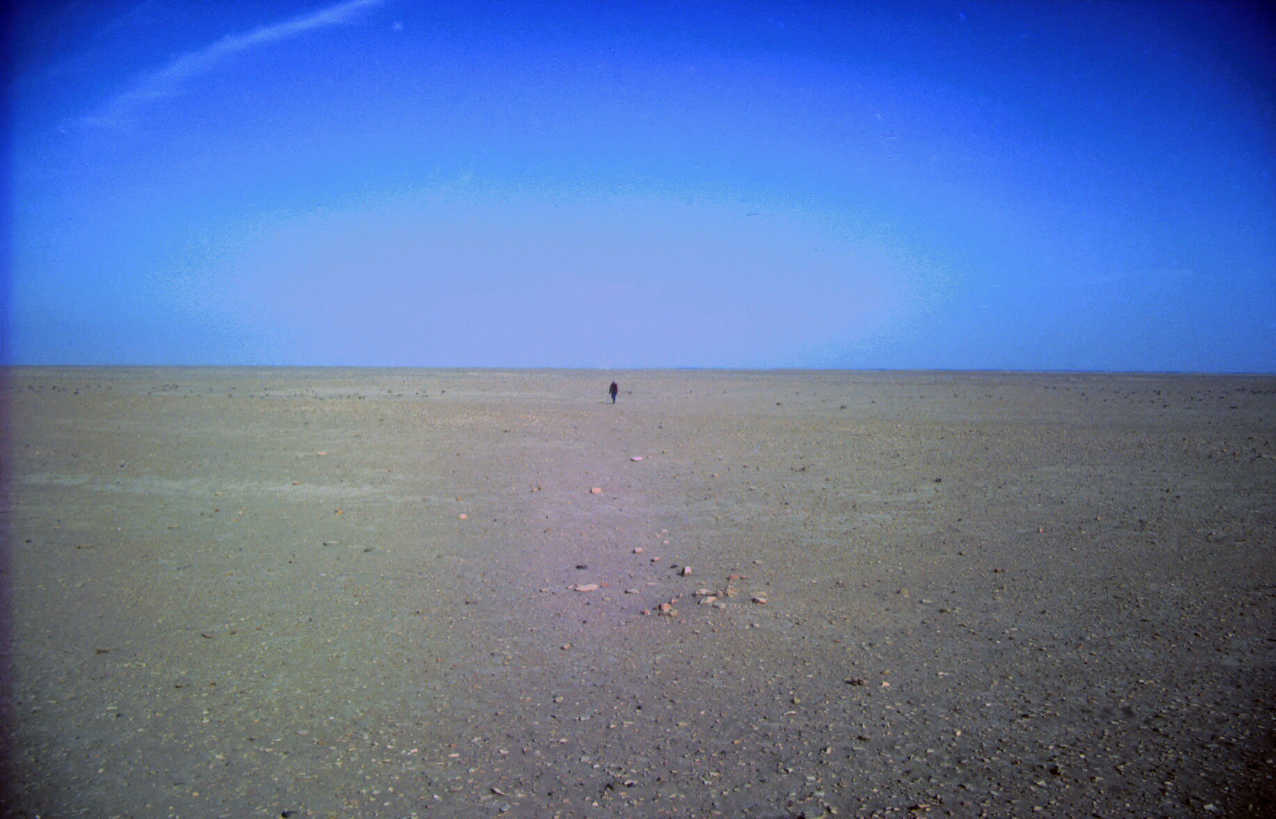
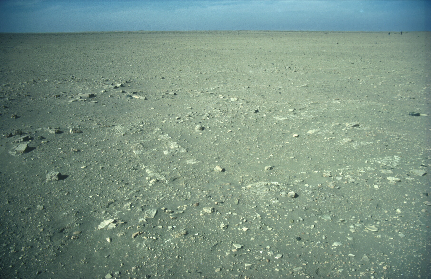
View across the site (with a person for scale) taken during the surface survey undertaken in the late 1980s, showing the general topography and artiact scatters found in the region; photo © 2004 Elizabeth C. Stone; used with permission. |
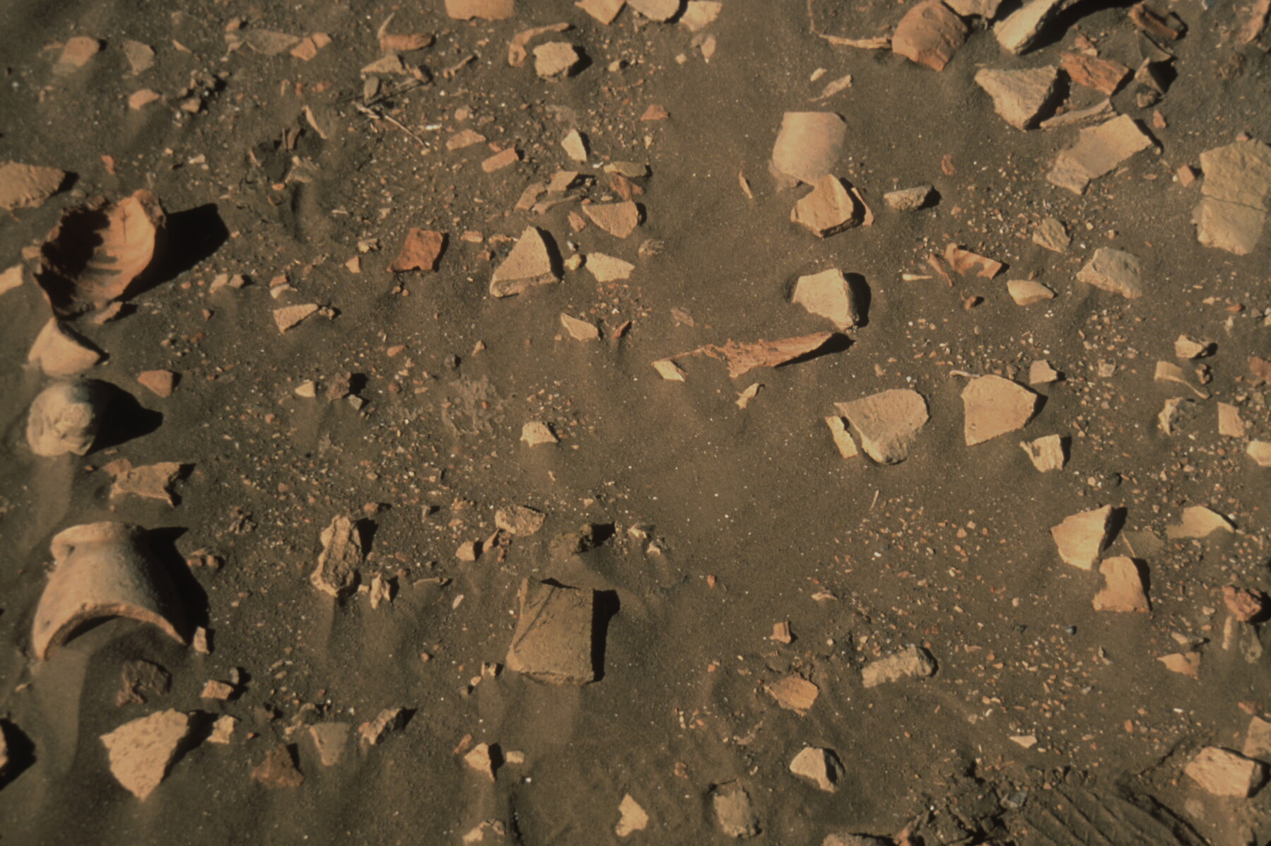 Closeup detail of the surface at Mashkan-shapir showing the density of the artifact scatter; photo © 2004 Elizabeth C. Stone; used with permission. |
A City Divided
The remains of the large city as discovered through excavation, surface survey, satellite imagery interpretation, and aerial photography using a camera-bearing kite, show an urban center quite unlike what had been our presumed view of early-second-millennium southern Mesopotamian cities. The extent enclosed within the city walls (apparently built by the Larsa king Sin-iddinam, who reigned only from c.1845 to 1843 BCE) is more than 70 hectares (about 170 acres) , making it at that time larger than the enclosed area of Ur. Investigations have revealed that the city was divided into distinct functionally separate precincts by a series of canals and two harbors, including areas for manufacturing, religion, residences, city administration, a large garden, and a cemetery.Reference
Page Created: October 5, 2004
Page Updated: January 1, 2012
URL:
Page Author: The Institute for the Visualization of History